How to Calculate Area for a Layer in Latitude and Longitude co-ordinates
The Shapefile which is normally available for download in most of the websites display locations (coordinates) in Latitude and Longitude, so these have to be reprojected to find the area of a feature. This reprojection procedures have been explained in a separate article. In this article lets see the steps to compute area from the excisting shape file.
Method
1.Open QGIS 2.0 desktop.
2. Add the Delhi vector shapefile in the workspace of QGIS.
3. Reproject the shapefile to WGS84/ UTM Zone 43N in which Delhi lies.
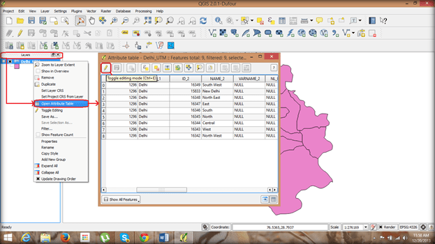
4. Right-click on the ‘Layers’ and choose ‘Open Attribute Table’.
5. The table opens on which click ‘Toggle editing mode’.
6. This opens up some new options in the attribute table, from which click ‘Open field calculator’
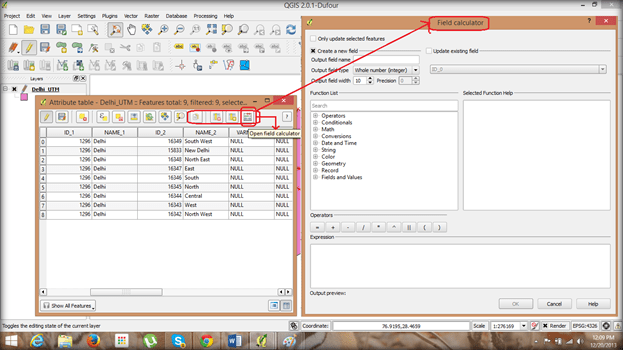
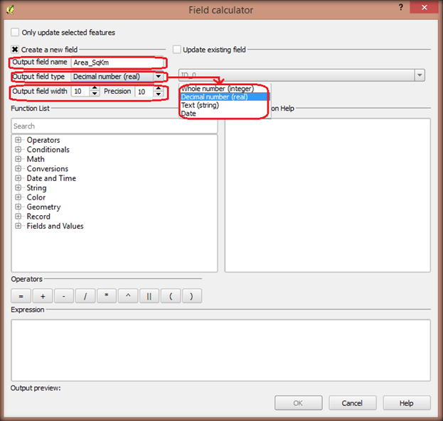
7. In the ‘Field calculator’ dialog box choose ‘Create a new field’ and provide a name in output field and ‘Decimal number’ in field type along with field width and precision as 10.
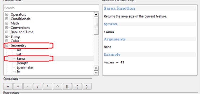
8. From the function list choose ‘Geometry’ from which select ‘$Area’ option.
9. Place ‘$Area’ option in the expression space and click ok. The default area option provides area in square metre (Sqm).
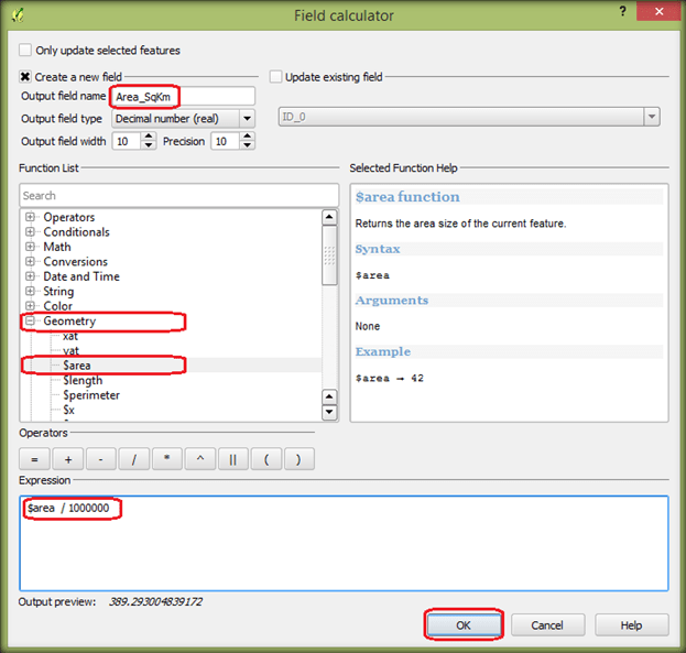
10. To Display the area in either SqKm or Hectare choose the corresponding expression and click ok.
-
-
SqKm – $Area/1000000
-
Hectare – $Area/10000
-
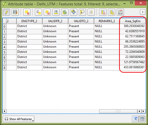
11. Check the attribute table to view the newly created field with the area being displayed.
12. The attribute table displays the area in SqKm of Delhi UT with all its districts.