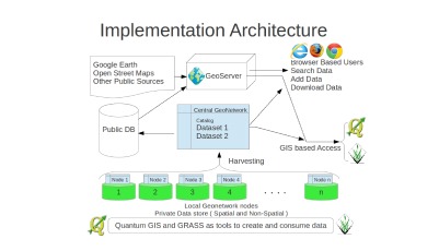
GeoNetwork Implementation
Our Customer was looking to share data between multiple office locations. They also wanted to provide map services to a set of clients as required. And some of their datasets were propreitary and hence would...
Our Customer was looking to share data between multiple office locations. They also wanted to provide map services to a set of clients as required. And some of their datasets were propreitary and hence would...

kCube used its data analysis expertise to build a platform to curate and transform large datasets into actionable information. This platform was built to manage spatial and non-spatial data which allowed the...
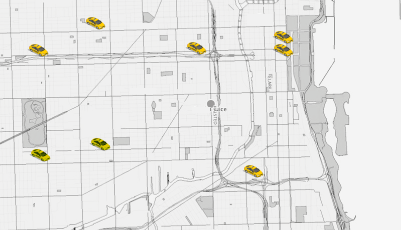
Fleet management is an integral part of Supply chain management. Our clients were mainly small businesses with fleets smaller between 30 to 70 vehicles. Purchasing off the shelf enterprise systems was outside...
kCube developed translation tools to help executives comfortable with MS Excel to use Google Maps for display and interpretation of results. Open Source Library GDAL and OGR were used to link excel tables...
Encroachments along the utility lines need to be managed. Client had collected orthophotos, helicopter based high resolution video alongwith list of approved encroachments along their entire Right of Way...
Client side web mapping framework API was built on top of OpenLayers. OpenLayers is very flexible to integrate it in any web page for web map display and is developed using pure Javascript library which...

MODIS, Landsat datasets were primarily used to identified deforestation in the rainforests across Indonesia. These deforestations were then tracked to identify whether Palm plantations were planted or natural...
Our client is a solution provider to Utility companies. There has been a huge push to update underlying datasets at a faster pace than before. Ground collection of data has increased manifold with the ease of...
Client wanted to update the existing NHD dataset to match its current state after the year 2005 Natural disaster in Louisiana Coastal areas, USA.ClientClient is an experienced provider of GIS services to...
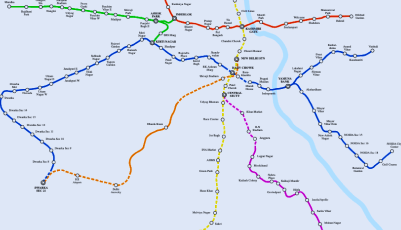
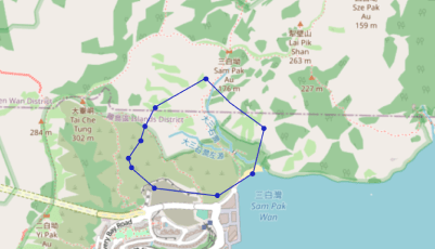
Every regional office of India Post has many delivery routes called beats with each beat assigned to a particular postman/postwoman for the delivery of articles. The sequence in which the postman/postwoman...
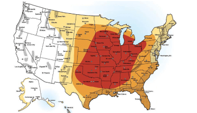
The weather insurance market is still in a nascent stage. The market players are practically working blind which is one of the reasons why the market is still operating so inefficiently. The Micro Insurance...
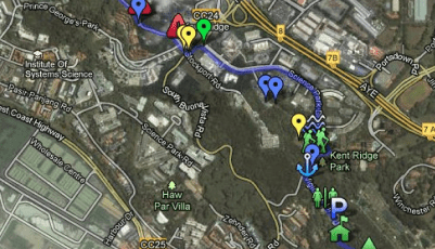
Managing of Spatial and Non-spatial datasets on assets of an organisation in general is challenging, in addition to maintaining records, the option to query, visualize and map can be done only using a full...